Online Catalogue with all Lots / Auction 157
Rare Books, Prints, Historical Photography
Friday, 24 October 2025 at 11:00 am Lose 1- 1105
Saturday, 25 October 2025 at 11:00 am Lose 1106-2003 - After sale
Lot 1657 (Johannes Walbeeck). Iovrnael van de Nassausche …
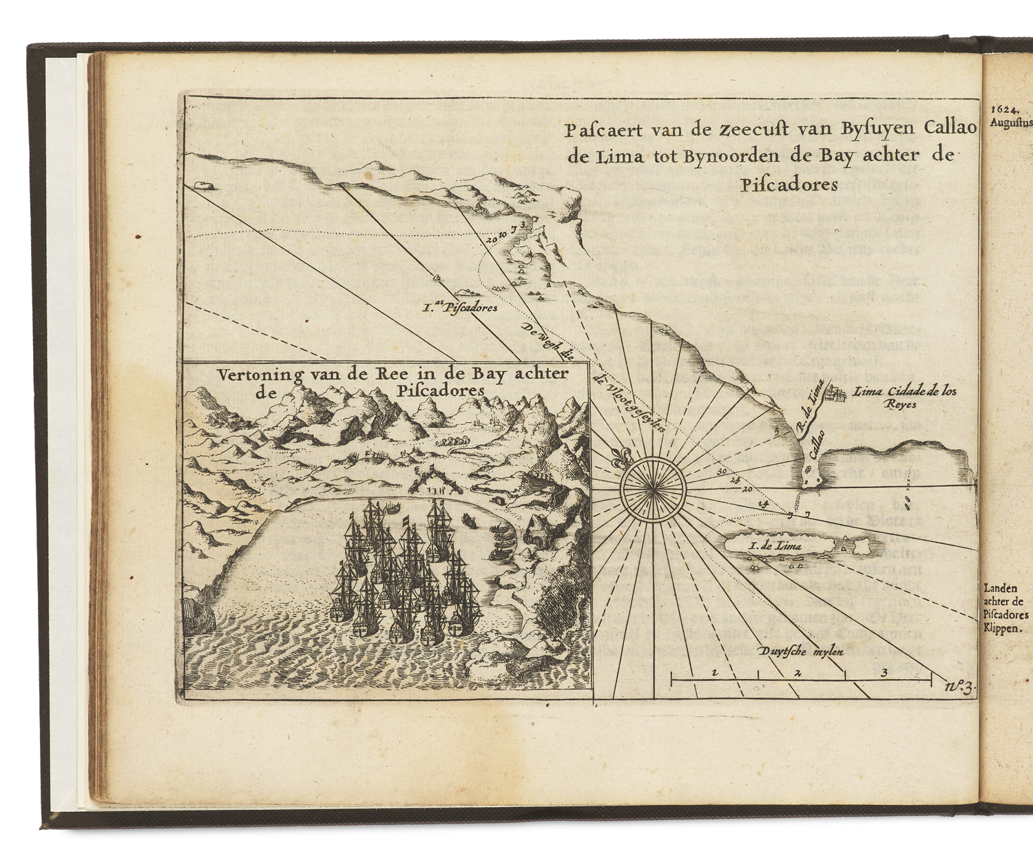

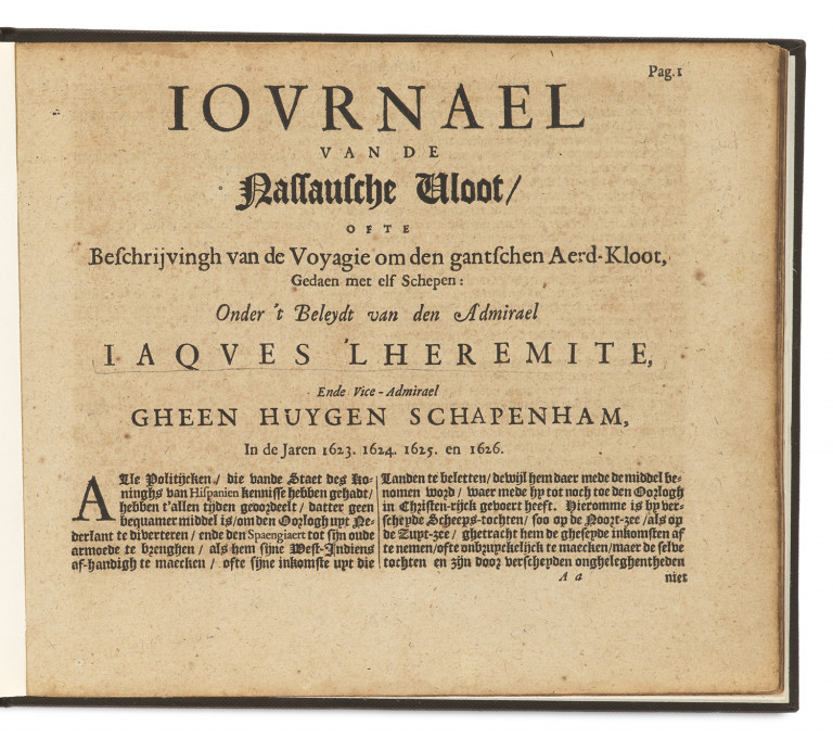
Iovrnael van de Nassausche Vloot. Ofte Beschrijvingh van de Voyagie om den gantschen Aerd-Kloot, Gedaen met elf Schepen: Onder 't Beleydt van den Admirael Iaqves 'L Heremite (...) In de Jaren 1623. 1624. 1625. en 1626. Mit 3 Tafeln in Radierung, darauf Karten und Ansichten und Schlussvign. im Holzschnitt. o.O., Dr. u. J. (Amsterdam, Jan Janssonius, 1645). 79 S. Quer-4°. Mod. Lwd. (berieben und bestoßen).
Südamerika
Geographie und Reisen – Sabin, J. Dictionary of books relating to America from its discovery to the present time, Bd. IV, 14957. - Tiele, P. A. Journaux des navigateurs neerlandais, 77e. - Bericht über die Erdumsegelung von Jacques le Clerc (1623-26), der 1624 erstmals auch die chilenischen Hermite-Inseln in der Nähe von Kap Hoorn kartographierte. Hauptziel der im Auftrag der niederländischen Ostindien-Kompagnie durchgeführten Reise war es, einen schnelleren Weg zur Umschiffung der Südspitze Amerikas zu finden, über den die Holländer die Molukken von Osten her erreichen konnten. Vorliegender Text, der zu den ersten Ausgaben von 1626 und 1643 u.a. um eine Beschreibung von Chile und Peru erweitert ist, wird dem mit Le Clerc als "Mathematiker" reisenden Kartographen Johannes Walbeeck (1602-1649) zugeschrieben und erschien als ein Teil von Commelins Sammelwerk über die Fahrten der Niederländischen Ostindien-Kompagnie. - Seiten gebräunt, minimal stockfleckig. Eine Karte stärker felckig. Insgesamt gut erhalten mit prachtvollen, ganzseitigen Karten.
Geography and Travel – South America. - With 3 etched plates, depicting maps. Modern canvas (rubbed and bumped). - It is worth to mention that durching Le Clerc's voyage the Chilean Hermite Islands near Cape Horn were cartographed for the first time. The main aim of the voyage, which was carried out on behalf of the Dutch East India Company, was to find a better way to circumnavigate Cape Horn, via which the Dutch could easier reach the Moluccas from the east. Present text, which compared to the first editions of 1626 and 1643 also includes a description of Chile and Peru, is attributed to the cartographer Johannes Walbeeck (1602-1649), who travelled with Le Clerc as a 'mathematician', and was published as part of Commelin's collected works on the voyages of the Dutch East India Company. - Pages browned, minimal foxing. One map more heavily foxed. Overall well preserved with splendid, full-page maps.
Post Auction Price: 400 €
Premium and taxation
This work is subject to under the regular margin scheme. There is a 24.95% buyer's premium on the hammer price and inside the EU 7% (Books, Paintings, Drawings and most Prints) and 19% (Photographs, Screen and Offsetprints, Autographs and Manuscripts) VAT on the final invoice amount.
Shipping
A pickup of this work is possible in our premises at Potsdamer Str. 16, 14163 Berlin by appointment. If you wish a shipment of the work, please contact us for a consultation and shipping calculation. Framed tickets are shipped exclusively by a shipping company due to the risk of breakage. Postal shipping is only carried out at the express request and risk of the buyer.
Terms and Conditions
You can view our terms and conditions here
Droit de Suite
On the sales proceeds of all original works of fine art and photography, whose authors have not yet died 70 years before the end of the sale, an additional 2% (subject to change) of the hammer prices from 400€ will be charged pro rata for the VG Bild-Kunst, which represents the copyrights of visual artists according to § 26 UrhG.
Submit a bid
I would like to participate in your auction by accepting the General Terms and Conditions of Jeschke van Vliet Auctions Berlin GmbH.