Online Catalogue with all Lots / Auction 161
Rare Books, Prints, Historical Photography
Saturday, 24 October 2026
Lose 1 - 1706 - After sale
Lot 412 Attilio Zuccagni-Orlandini. Carta dell' Italia in …
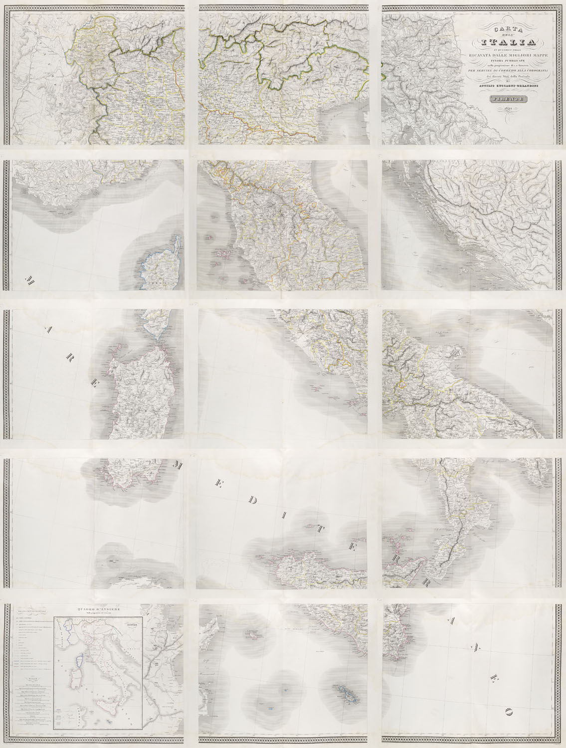
Carta dell' Italia in quindici fogli. 15 in gelb, grün, rosa und hellblau grenzkolorierte Kupferstichkarten aus dem "Atlante geografico degli stati italiani", mit Ortspunkten und -bezeichnungen, Berg- und Gewässerstrichen sowie grafischem Maßstab 1:600.000). Florenz, o Dr. (Società Editrice), 1842. Ca. 60 x 47 cm (Plattengröße) und ca. 87,5 x 61 cm (Blattgröße). Einmal gefaltete und einseitig bedruckte lose Bogen voluminösen Büttenpapiers (recto in Blindpräg. monogrammiert) mit verstärktem Mittelfalz (dieser mit Einrissen und Kleberesten einer ehemaligen Bindung).
Italien
Geographie und Reisen – Monumentale Karte Italiens im Ausmaß von insgesamt 2,35 x 1,80 m. - Die Aussenränder der fein gezeichneten und kräftig gestochenen Kartenblätter mit attraktivem, mittels doppelter Linie eingefasstem Flechtwerk gerahmt. Bl. 3 mit großer typographischer Titelkartusche, Bl. 13 mit Überblickskarte und ausführlichen Legenden sowie Maßstabsangaben (8 verschiedene ital., dazu österr. u. engl. Meilen, franz. Ligen sowie Kilometer). - Zuccagni-Orlandinis "Atlante geografico degli stati italiani" (1842-44) erschien in 3 auf 2 Bände verteilten Teilen: Bd. 1 enthielt vorliegende Karte sowie 52 Karten zu Oberitalien, Bd. 2 umfasste 77 Karten zu Unteritalien. - Durchgehend aber mit großteils nur schwach sichtbaren Wasserflecken, sonst gut erhaltene Blätter mit vollem, unbeschnittenem Rand.
Geography and Travel – A monumental map of Italy measuring 2.35 x 1.80 m, consisting of 15 border coloured copperplate sheets. Loose sheets of thick handmade paper, folded once and printed on one side (with a monogram embossed on the front), featuring a reinforced centre fold (which shows tears and traces of glue from a previous binding). - The outer margins of the finely drawn and boldly engraved map sheets are framed by an attractive interlaced border outlined by a double line. map sheet 3 with a large typographic title cartouche, map sheet 13 with an overview map and detailed legends, as well as scale indications (8 different Italian, plus Austrian and English miles, French leagues and kilometres). - Zuccagni-Orlandini's *Atlante geografico degli stati italiani* (1842-44) was published in three parts bound in 2 volumes: Vol. 1 contained present map in 15 sheets and 52 further maps sheets of Northern Italy, whilst vol. 2 comprised 77 maps of Southern Italy. - Throughout but with mostly faint water stains, otherwise well-preserved sheets with full, uncut margins.
Result: 330 €
Premium and taxation
This piece is subject to differential taxation. There is a 29,85% buyer's premium on the hammer price. The value added tax is included but not displayable according to §25a UstG.
Shipping
A pickup of this work is possible in our premises at Potsdamer Str. 16, 14163 Berlin by appointment. If you wish a shipment of the work, please contact us for a consultation and shipping calculation. Framed tickets are shipped exclusively by a shipping company due to the risk of breakage. Postal shipping is only carried out at the express request and risk of the buyer.
Terms and Conditions
You can view our terms and conditions here
Droit de Suite
On the sales proceeds of all original works of fine art and photography, whose authors have not yet died 70 years before the end of the sale, an additional 2% (subject to change) of the hammer prices from 400€ will be charged pro rata for the VG Bild-Kunst, which represents the copyrights of visual artists according to § 26 UrhG.
Submit a bid
I would like to participate in your auction by accepting the General Terms and Conditions of Jeschke Jádi Auctions Berlin GmbH.